

- We're not spying on you; it's more interesting watching grass grow– Using Unmanned Aircraft Systems in Rangeland Monitoring (C Maxwell) - Interest in using unmanned aircraft systems (UAS) for rangeland monitoring and other research purposes has increased rapidly. This presentation contains an overview of FAA requirements for UAS flights in the national airspace system (NAS), how UAS flights are conducted on the Jornada Experimental Range (JER) in both restricted airspace and the NAS, and data applications from UAS flights that have been conducted on the JER since 2006 for multiple research projects.
- Unmanned Aircraft Systems - Data Applications (Watching Grass Grow) (C Winters, et al.) - Red-green-blue (RGB) images present data similar to what the human eye would see. Color infrared (CIR) images show the reflected near-infrared band (825-925nm) that is invisible to human eyesight. Normalized difference vegetation index (NDVI) is a widely used vegetation index used to quantify the presence of vegetation by exploiting the fact that chlorophyll both reflects infrared and absorbs red.
- Characterization of Shrubland-Atmosphere Interactions Through Use of the Eddy Covariance Method, Distributed Footprint Sampling, and Imagery from UAV’s (C Anderson, E Vivoni, A Rango) - Background and Motivation- Eddy covariance (EC) tower: common scientific tool to measure ecosystem-scale evapotranspiration (ET) fluxes; Purpose of EC: connect land surface states with atmospheric fluxes; Traditional approach: use one soil moisture probe location and assume it represents EC footprint state; Problem: is this assumption reasonable in heterogeneous terrains (such as in the southwestern U.S.)?; Goal of study: improve the implementation of the EC method, inform the EC results of previous studies, better model semiarid ecosystems for prediction of future land cover regimes and their consequent effects on water resources.
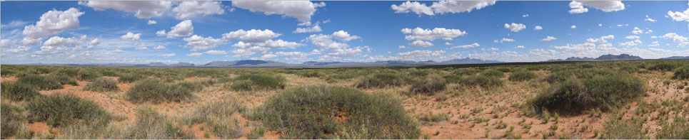
- Phenological Patterns of Chihuahuan Desert Perennial Grasses and Shrubs in Normal and Below-Average Precipitation Years (D Browning, M Mattocks) - Arid and semi-arid regions of the southwestern USA are especially sensitive to changes in temperature and drought frequency and intensity (Overpeck and Udall 2010). Observations of plant phenology in these water-limited environments coincident with readily-available data to characterize local meteorology and soil moisture conditions are uncommon. We compare and contrast phenological patterns for three C4 grasses and three C3 shrubs in the Chihuahuan desert for 2010 and 2011 growing seasons.
- Hydrology With Unmanned Aerial Vehicles (UAVs) (A Rango, E Vivoni) - Hydrological remote sensing often relies on operational satellite products that require expensive and infrequent aircraft observations as well as ground-based measurements for validation. As data from new, hydrologically-relevant satellite missions, such as, the Soil Moisture Active-Passive (SMAP) mission and the Landsat Data Continuity Mission (LDCM) become available, there is a pressing need for more frequent and less expensive techniques for validating satellite retrievals that can also be integrated with ground sensor networks.
- Patterns in reproductive phenology for Chihuahuan desert grasses and shrubs from 1993 to 2010 (D Browning, J Anderson, D Peters) - In arid and semi-arid regions of southwestern U.S., rainfall is highly variable between years and across space. Climate forecasts for these regions include increases in temperature and variability in rainfall. Phenology is salient indicator of plant responses to climate. Long-term records of phenology for species in arid environments are rare.
- Change Detection Using 75-Year Aerial Photo and Satellite Data Sets, Inexpensive Means to Obtain 6 cm Resolution Data, and Developing Opportunities for Community-Oriented Remote Sensing through Photography (A Rango, A Laliberte, C Winters, C Steele, D Browning)
- Bridging Field Observations and Remotely Sensed Assessments of Land Surface Phenology in the Arid SW US (D Browning, A Rango, J Anderson, D Peters) - Bridging field observations and remotely sensed assessments of land surface phenology in the arid southwestern US. Relating field observations of plant phenological events to remotely sensed depictions of phenology remains a challenge to the vertical integration of data from disparate sources. Different scales of observation, land surface heterogeneity, and timing of observations have precluded clear relationships between field perspectives of phenology and phenological events discernable with satellite remote sensing.
- Past, Present, and Future Capabilities of Remote Sensing for Assessing Watershed and Rangeland Change (A Rango) - Historic data of many types are available for watershed and rangeland management, monitoring, and assessment of change. Remote sensing data for the past is available, and both traditional and recently developed technologies are currently in use.
- Rangeland Resource Assessment, Monitoring, and Management Using Unmanned Aerial Vehicle-based Remote Sensing (A Rango, A Laliberte, K Havstad, C Winters, C Steele, D Browning) - We own and fly a small Unmanned Aerial Vehicle (UAV). The system consists of an airplane, weighing about 22 lbs., a catapult launcher, and a computer control system, all costing $48,000. It comes with a video camera and a consumer grade digital camera (10 mp). But we are in the process of replacing the video camera with a 6-band multispectral camera (Tetracam MiniMCA). Purchase from a UAV manufacturer that supplies not only training but continuing technical support is recommended.
- Rangeland Resource Assessment, Monitoring, and Management Using Unmanned Aerial Vehicle-based Remote Sensing (A Rango, A Laliberte, K Havstad, C Winters, C Steele, D Browning) - We fly a small Unmanned Aerial Vehicle (UAV). The system consists of an airplane, weighing about 22 lbs., a catapult launcher, and a computer control system, all costing $48,000. It comes with a video camera and a consumer grade digital camera (10 mp). But we are in the process of replacing the video camera with a 6-band multispectral camera (Tetracam MiniMCA). Purchase from a UAV manufacturer that supplies not only training but continuing technical support is recommended.