
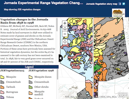
Disclaimer and Legal Statement: This material is based upon work supported by the National Science Foundation under Grant number DEB-0618210. Any opinions, findings, conclusions, or recommendations expressed in the material are those of the author(s) and do not necessarily reflect the views of the National Science Foundation or New Mexico State University.