| Products: | |||
|
Spatial data with ecological site name and state code (1:13,000 – 1:16,000)
|
|||
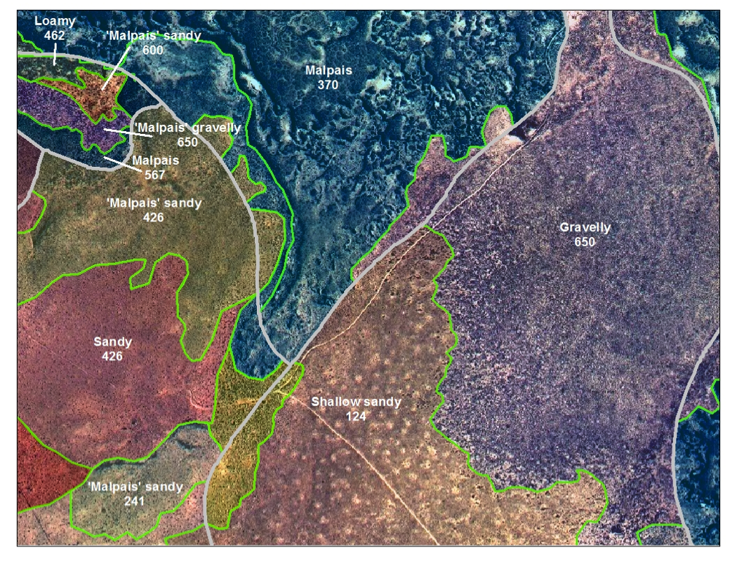
| The final product is a state map that lists the ecological site name and the three-digit state code. State mapping is typically done at 1:4000 to 1:5000 so this produces a fairly fine-resolution map. Recall that ecological state map polygons are child polygons of soil map unit polygons. Ecological state polygons attributed with the same ecological site and state code, but belonging to different soil map units are NOT merged. This allows ‘scaling up’ to create summaries at the soil map unit level, as well as analyses to be performed by soil map unit. | |||
|
Spatially explicit ecological sites
|
|||
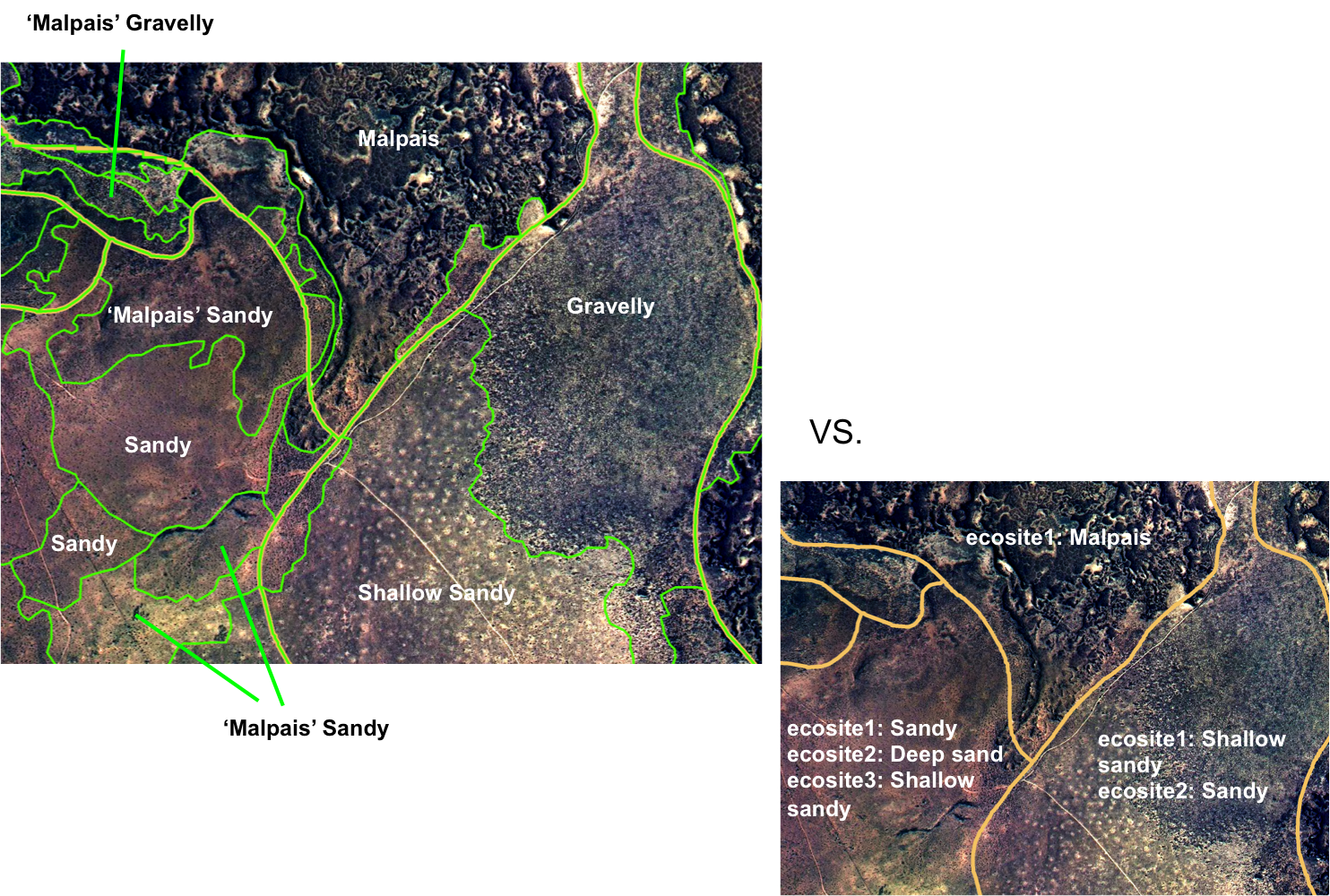
| The state map provides spatially explicit delineation of ecological sites and states. State maps offer several advantages compared with ecological site maps offered through products such as the Web Soil Survey (https://websoilsurvey.nrcs.usda.gov). Spatial layers of ecological sites based strictly on soil map units provide you with the potential ecological sites based upon the dominant soil components believed to be in the soil map unit. The dominant ecological site is listed first; it is the ecological site correlated to the soil component comprising the most area within the soil map unit. Individual ecological sites are typically not spatially explicit, which can be problematic in soil map units with several components. In addition, the ecological sites that are linked to a soil map unit are only based on dominant soil components; soil inclusions are not represented. The spatial resolution of state mapping (1:13,000-1:16,000) facilitates delineating ecological sites that occur at scales finer that that of the typical Order 3 soil survey (1:24,000 – 1:100,000). | |||
|
Spatially explicit ecological states
|
|||
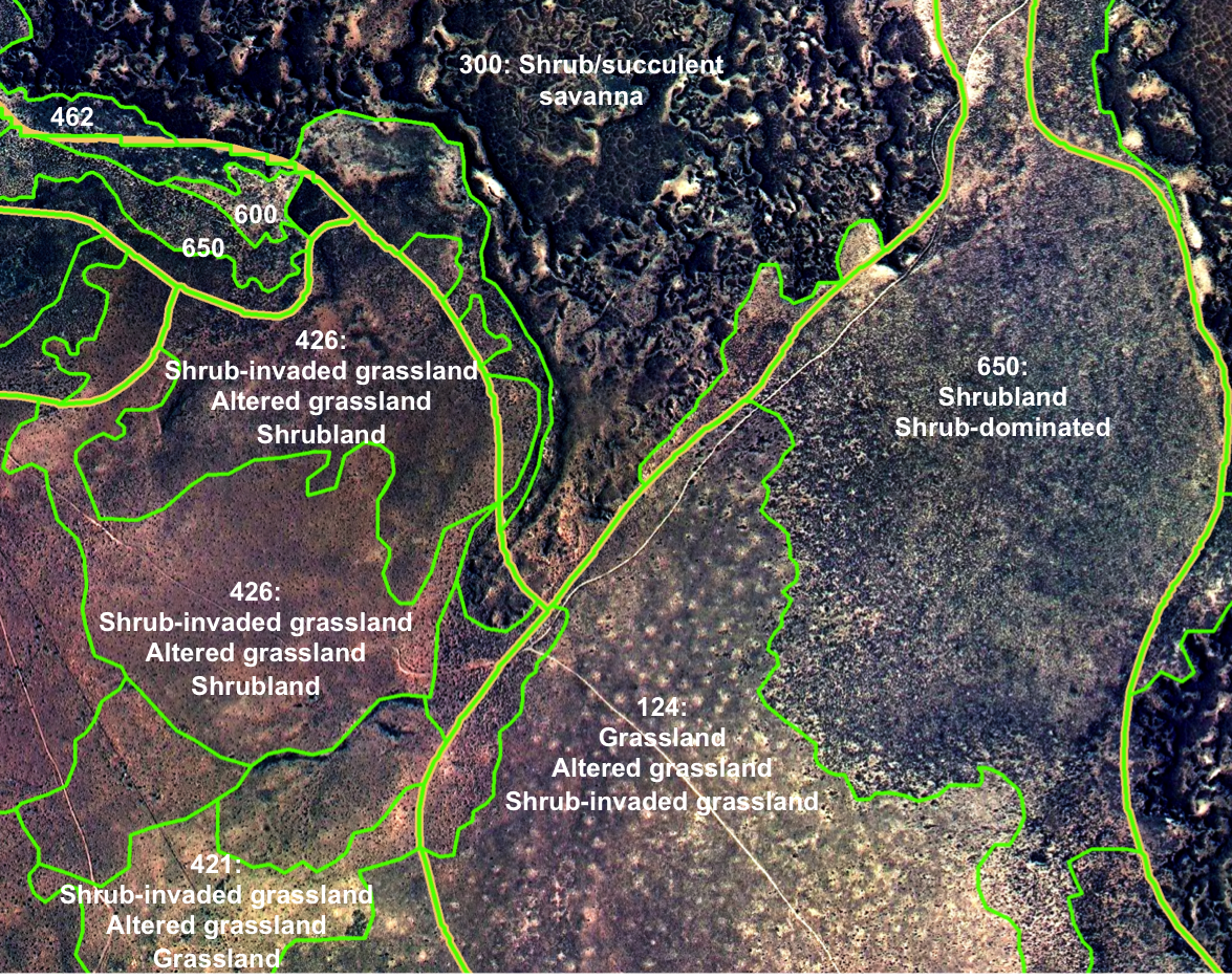
| The state map also provides spatially explicit ecological states, which are linked to information of the STMs of ecological sites. The user can refer to ecological site descriptions and STMs to infer the potential of an area to respond to management and climate. | |||
|
|
 |
||
Quick links:
|
|||