Here we provide some initial resources for those interested in developing ecological site descriptions. Formal protocols are being developed, so we include these resources for the benefit of those who are involved in ongoing efforts.
Following Bestelmeyer et al., (2009) and Moseley et al., (2010), we provide dataforms that can be used in vegetation and soil inventory. The sampling units we have used are 20 x 20 m (400m2) plots with a soil pit at the center. The Low Intensity Traverse form can be used to gather large numbers of samples across a project area and develop initial ecological site concepts. The Medium Intensity Plant Inventory can be used to collect quantitative data on vegetation using either ocular estimation of cover and/or production, line point intercept (LPI), or both. In high cover, high diversity environments, LPI is often preferred, whereas ocular estimates are useful in low cover and patchy environments and to record species that are rare at a site. Procedures for High Intensity Inventory are discussed in the Soil Change Guide and are used to provide detailed characterizations of an ecological state, often the reference state and community phase of an ecological site. The Medium or High Intensity Soil Characterization form can be used to collect information about the soil profile alongside vegetation data. 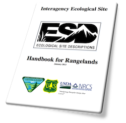 Finally, the Medium or High Intensity Pedoderm and Pattern Classes form is used to gather information about soil surface properties in conjunction with vegetation and soil profile measurements.
A link to the Rangeland/ESD development database aka Database for Inventory Monitoring and Assessment (DIMA) is provided because there are forms in the database that accommodate data produced using these dataforms. Information about monitoring and assessment methods useful for ESD development (including LPI) is provided in Monitoring and Assessment resources and instructions for the use of the Pedoderm and Pattern Classes is provided in the Field Guide. We also provide some links to additional resources pertaining to climate, soils, and vegetation classification that can be used in ESD development.
| Data forms for ESD development | Methods for ESD Development | Additional ESD Development Resources |
Low Intensity Traverse (v. 3.1) Medium Intensity Plant Inventory High Intensity Inventory - refer to Soil Change Guide, Appendix 3 Medium or High Intensity Soil Characterization Medium or High Intensity Pedoderm and Pattern Classes (v. 3.0)
| Domin-Krajina (DK) Cover Class Method DK Cover Class Reference Sheet A Field Guide to Pedoderm and Pattern Classes Pedoderm and Pattern Class Workshop - slides in pdf Monitoring and Assessment resources (also contains dataforms)
| Interagency Ecological Site Description Handbook for Rangelands * Rangeland/ESD development database aka Database for Inventory Monitoring and Assessment (DIMA) (MS Access) National and International Vegetation Classification and data access |
_______________________________
* Interagency Ecological Site Description Handbook for Rangelands - A handbook describing the process of ecological site description development by the USDA Natural Resources Conservation Service, Bureau of Land Management, and the US Forest Service. In 2010, these three agencies signed a Rangeland Interagency Ecological Site Manual to advance ecological site classification as a means to improve their ability to manage the landscape in a coordinated manner across ownership and jurisdictional boundaries. Ecological sites classify land areas according to their potential vegetation and responses to disturbance. Ecological site descriptions house information about the ecosystem services provided by ecological sites and their ecological dynamics, indicators of ecosystem change, and best management practices via state-and-transition models. The publication of the handbook effectively links a unified set ecological concepts and methodological approaches to the land management activities of three major federal agencies. Concerted development and refinement of a national ecological site classification system will improve our nation’s ability to harvest and deliver knowledge to improve adaptive management in rangelands, croplands, and forests. Download the Interagency Ecological Site Handbook for Rangelands here, or go to https://directives.sc.egov.usda.gov/33151.wba.