 |
|||
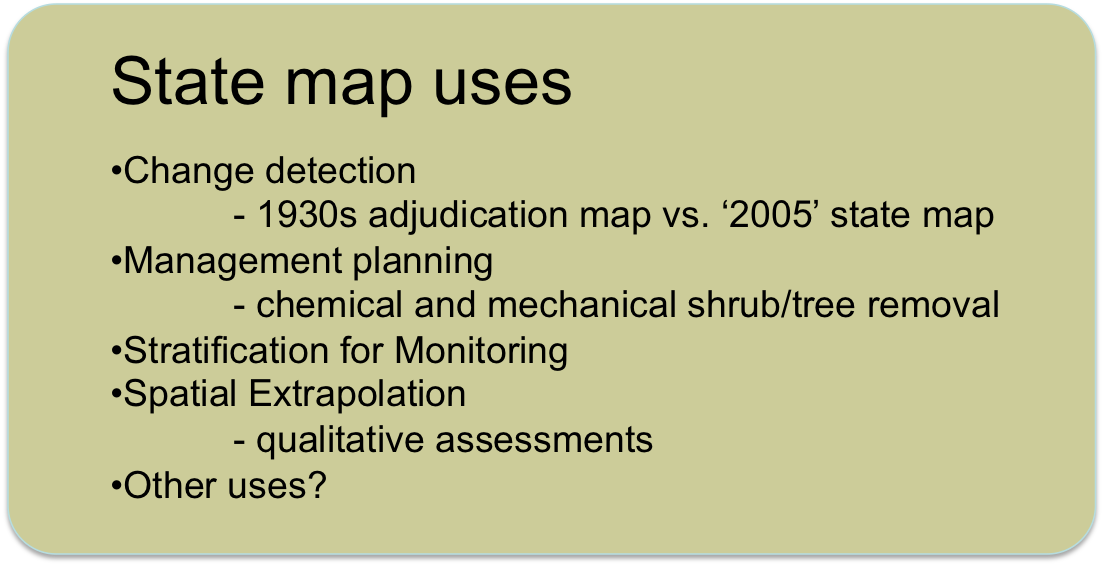
| There are many potential uses for state maps. They are a useful tool for planning and prioritizing management efforts. State maps can be used to provide stratified randomization for monitoring efforts. Qualitative assessments can be extrapolated using state maps. | |||
|
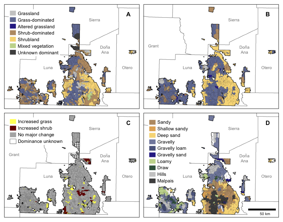
Change detection: 1930s adjudication map vs. 2005 state map State maps can also be used to represent broad-scale patterns of state change. This example shows 1930s adjudication map polygons classified by A generalized ecological state based on 1930s data, B generalized ecological state based on 2005 data, C major state changes (a departure of 2 or more generalized states) between the 1930s and 2005, and D dominant ecological site. See Williamson, JC, et al., 2011. Reinterpreting Historical Data for Evidence-Based Shrubland Management. Natural Resources and Environmental Issues. Vol. 17, Article 18. State change detection can be performed by comparing historical vegetation maps against a modern state map for the same location. The state maps also lend themselves to tracking change into the future; the state map could be reattributed at some point in the future and analyzed to detect polygons that did and did not change, and whether the change involved an increase or decrease in shrubs, grass, etc. |
|||
Management planning: Shrub removal treatments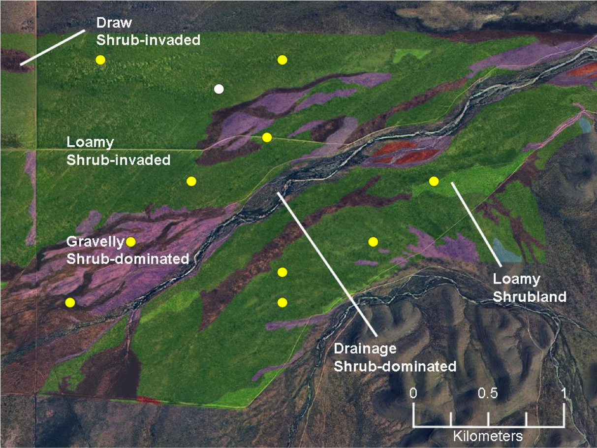 |
|||
| The state map can be applied to determine where to focus limited management funds. Polygons in shrub-dominated and shrub-invaded grassland states, due to the presence of perennial grasses in those states, would have a greater potential to respond to shrub removal with an increase in grass cover than would shrubland states featuring few or no perennial grasses. | |||
Spatial extrapolation: Qualitative assessments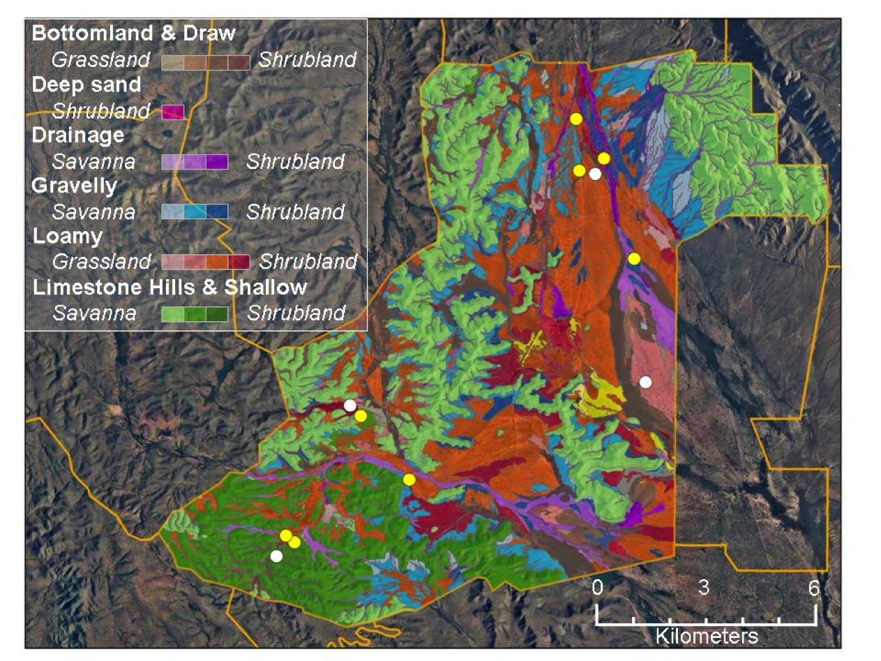 |
|||
| The state map can be used to allocate assessment locations using stratified random approaches within each of the dominant ecological sites and states can facilitate extrapolating point-based assessments to spatial units and entire landscapes. | |||
State mapping other uses: Where's the grass? 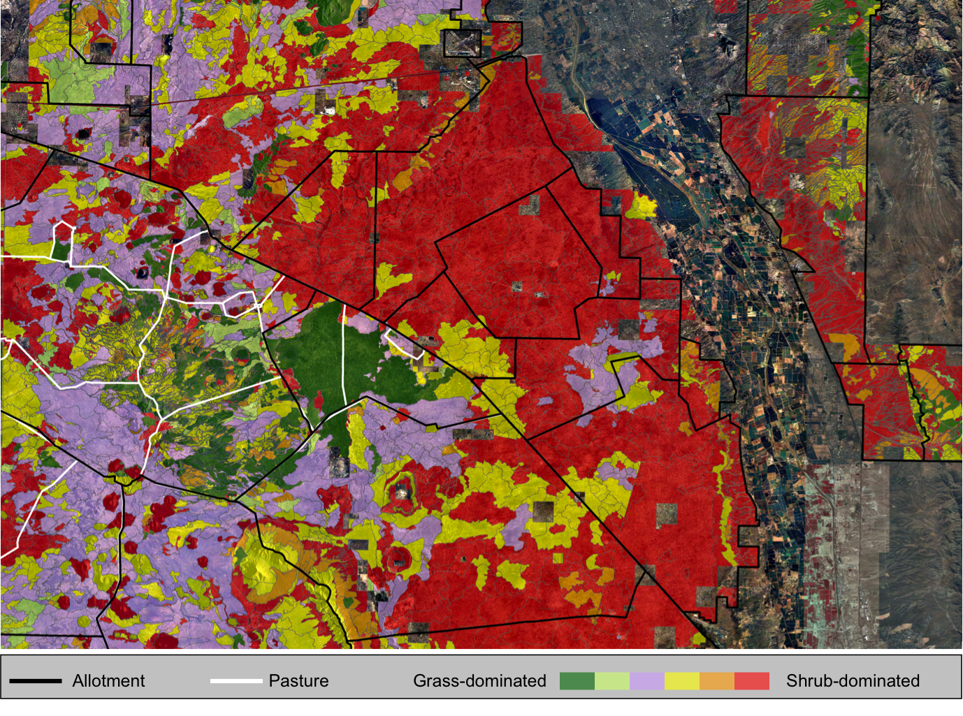 |
|||
| Both managers and researchers can use state maps to determine the extent and location of focal states within a landscape. | |||
|
|
|||
Quick links:
|
|||