|
|
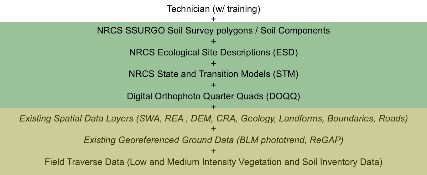
Several data elements are used to digitize and attribute a state map. Prior to assembling data, it is necessary to have a technician that is either highly trainable, or who has experience with characterizing soils, linking soils to ecological sites, determining vegetation states within ecological sites, and has the ability to think critically about the strengths and weaknesses of ESDs and STMs. Once a technician is in place, data assembly begins. The first four data elements in the list (highlighted in green) are required to delineate the polygons. The last three items, highlighted in olive, describe the types of data that can be used to attribute polygons with the correct ecological site name and state code. |
|