Spatial Data Catalog

Note: Email Ken Ramsey at datamanager@jornada-vmail.nmsu.edu to request access to any of the spatial data listed on this page.

Table of Contents    
1. Boundaries    
2. Climate Network    
3. Cultural Features   All GIS data layers are in UTM Zone 13N    WGS84,
unless otherwise noted.
4. Geographic Reference  

shapefile (*.shp, .shx, .sbn, .dbf, .sbx, .prj, and .shp.xml)
              *these files together produce a shapefile

raster image (*.img, .ige, .img.aux.xml, .img.vat.dbf, .img.xml, .rrd, .png)
               *these files together produce a raster dataset

5. Hydrology  
6. Land Cover  
7. Satellite Imagery  


JRN = Jornada Basin
JER = USDA-ARS Jornada Experimental Range
CDRRC = NMSU Chihuahuan Desert Rangeland Research Center
CDNP = Chihuahuan Desert Nature Park (Asombro)
CHIDES = Chihuahuan Desert


Boundaries (top)

Name Subcategory Description Image Metadata Download
Package

 
Last
Updated

 
2000_landform_map   A map depicting the different landforms in the JER boundary.       04/26/2006
cdnp_boundary   A boundary file for the Chihuahuan Desert Nature Park bmp htm zip 03/30/2006
cdrrc_boudnary   A boundary file for the Chihuahuan Desert Rangeland Research Center bmp htm zip 05/31/2006
chides_boundary   A boundary file for the Chihuahuan Desert. bmp htm zip 03/30/2006
da_county_boundary   A boundary file for Dona Ana County bmp htm zip 03/30/2006
dsp_boundary   Boundary for the Desert Soils Project.       02/06/2006
jer_boundary   Boundary for the Jornada Experimental Range. bmp htm zip 03/30/2006
nm_state_boundary   A boundary file for the State of New Mexico bmp htm zip 03/30/2006
swus_nmex_states_boundary   Boundary for the southwestern United States and some northern Mexico states.       02/06/2006
us_boundary   Boundary for the United States.       02/26/2006


Climate Network (top)

Name Subcategory Description Image Metadata Download
Package

 
Last
Updated

 
biodiversity_rain_gauge Rain Gauges Location file for the biodiversity rain gauges.       02/06/2006
cdrrc_rain_guages Rain Gauges Location file for the cdrrc rain guages.       02/06/2006
jer_recording_rain_gauges Rain Gauges Location file for the JER recording rain guages.       02/06/2006
jer_standard_rain_guages Rain Gauges Location file for the JER standard rain guages.       02/06/2006
lter_npp_graduated_rain_gauges Rain Gauges Location file for the LTER NPP graduated rain gauges rain gauges.       02/06/2006
lter_npp_tipping_bucket_rain_gauges Rain Gauges Location file for the LTER NPP tipping bucket rain gauges.       02/06/2006
jer_weather_stations Weather Stations Location file for the JER weather stations.       02/06/2006
lter_weather_stations Weather Stations Location file for the LTER weather stations       02/06/2006


Cultural Features (top)

Name Subcategory Description Image Metadata Download
Package

 
Last
Updated

 
jer_buildings Buildings Buildings on the JER       02/06/2006
jer_hq_buildings Buildings Headquater buildings in the JER.       02/03/2006
cdrrc_fences Fences Fences within the CDRRC boundary.       02/06/2006
jer_exclosure_fences Fences Exclosure fences within the JER boundary.       02/06/2006
jer_fences Fences Fences in the JER boundary.       02/06/2006
cdrrc_exclosures Pastures and Exclosures Exclosures within the CDRRC boundary.       02/06/2006
jer_exclosures Pastures and Exclosures Exclosure within the JER boundary.       02/06/2006
jer_pastures Pastures and Exclosures Pastures within the JER boundary.       02/06/2006
jer_pipelines Pipelines Pipelines in the JER       02/07/2006
chides_roads Roads Roads in the Chihuahuan Desert.       02/06/2006
da_county_roads Roads Roads in Dona Ana County.       02/06/2006
jer_roads Roads Roads within the JER boundary.       02/06/2006
cdrrc_watering_points Water Tanks Locations for watering points within the CDRRC boundary.       02/06/2006
jer_dirt_tanks Water Tanks A location file for the dirt tanks in the JER boundary.       02/07/2006
jer_metal_tanks Water Tanks A location file for the metal tanks in the JER boundary.       02/07/2006
jer_wells Wells Locations for wells within the JER boundary.       02/06/2006


Geographic Reference (top)

Name Subcategory Description Image Metadata Download
Package

 
Last
Updated

 
nm_public_land_survey_system   PLSS for New Mexico       02/06/2006


Hydrology (top)

Name Subcategory Description Image Metadata Download
Package

 
Last
Updated

 
chides_rivers   Rivers in the chihuahuan desert       02/03/2006
jrn_arroyo_network   Arroyo network for the JRN       02/06/2006
rio_grande   Rio Grande       02/06/2006


Land Cover (top)

Name Subcategory Description Image Metadata Download
(Shapefile)

 
Last
Updated


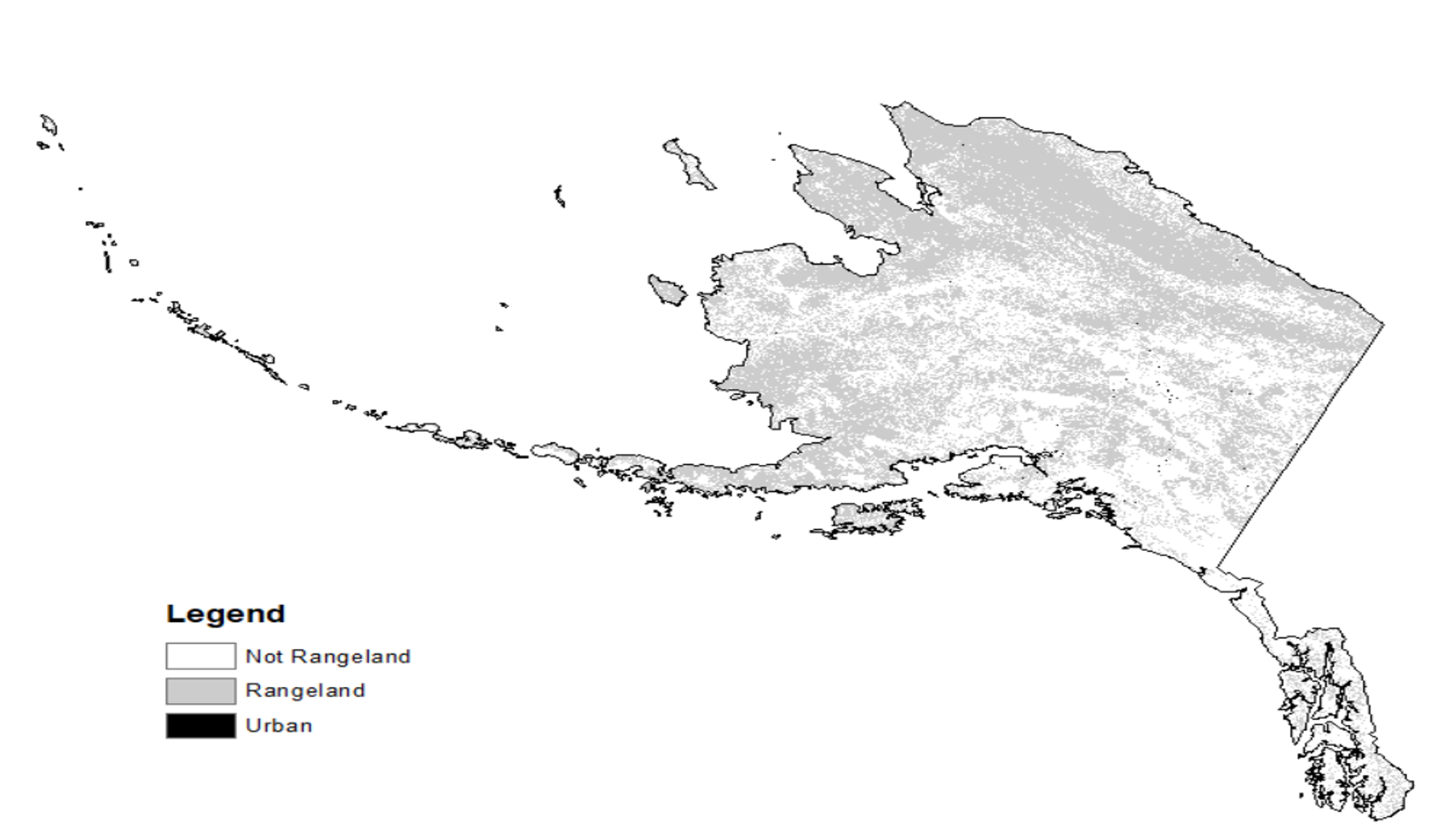
Rangeland_AK_2011_nlcd_reclass.img

Rangeland

This raster dataset was created to quantify the extent of rangelands in Alaska and produce a detailed spatial dataset that could be used to intersect with separate fire datasets as a way to explore the spatial and temporal relationships of fire and rangelands in Alaska.

projection: Albers_Conical_Equal_Area

datum:  D_North_American_1983

png xml zip 04/04/2019

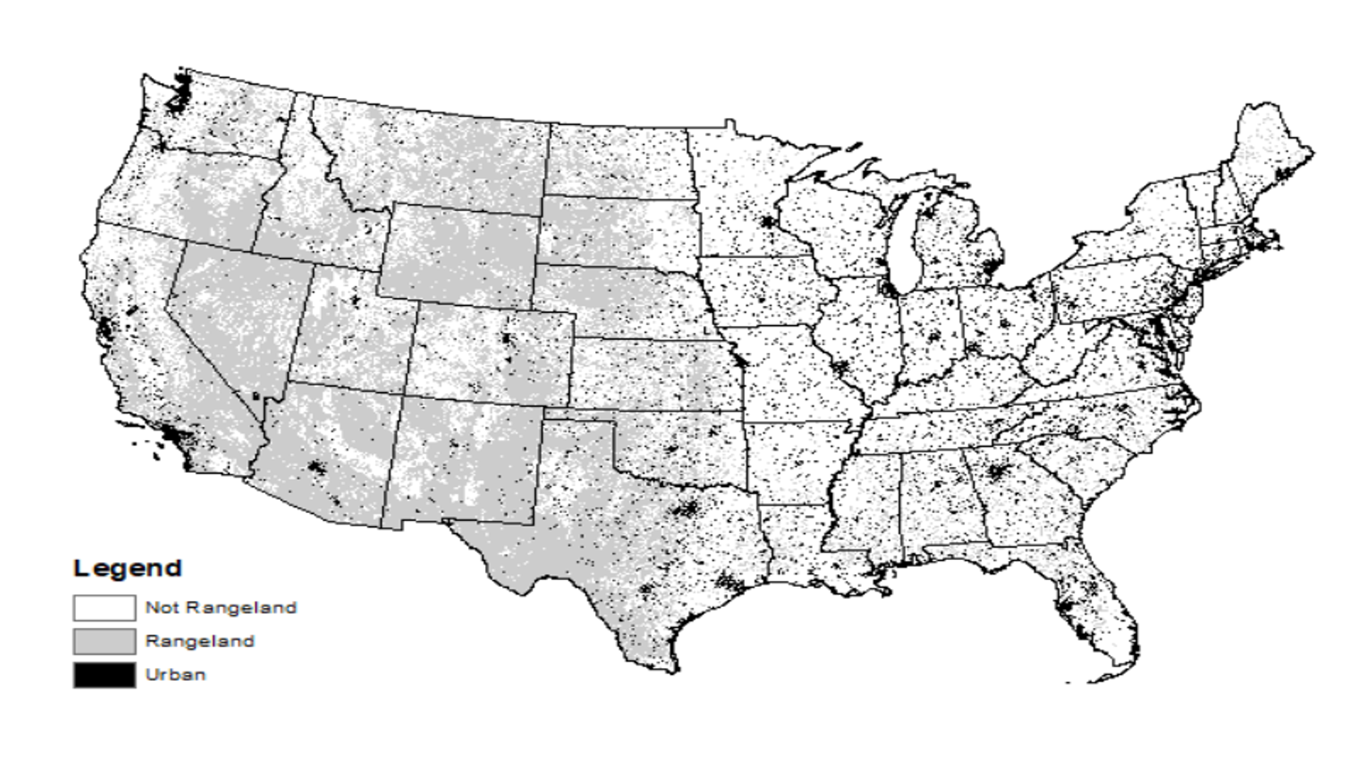
Rangeland_conus_2011_nlcd_reclass.img

Rangeland

This raster dataset was created to quantify the extent of rangelands in the continental United States and produce a detailed spatial dataset that could be used to intersect with separate fire datasets as a way to explore the spatial and temporal relationships of fire and rangelands in the continental United States.

projection: Albers_Conical_Equal_Area

datum:  D_North_American_1983

png xml zip 04/04/2019
jrn_edoqq.sid Aerial Photos DOQQ for the JRN       02/06/2006
jrn_edoqq.tif Aerial Photos DOQQ for the JRN       02/03/2006
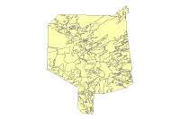
2000_physiography_map Geomorphology A map depicting the different physiography types in the JER boundary.       02/03/2006
2000_soil_parent_material_2000 Geomorphology A map depicting the different soil parent types in the JER boundary.       02/03/2006
da_county_soil_survey Soils Soil survey for Dona Ana County.       02/06/2006
dp_detailed_soils Soils Detailed soil map for the desert project.       02/06/2006
dp_general_soils Soils General soil map for the desert project.       02/06/2006
jer_soils_1918 Soils Soil map for JER 1918       02/06/2006
jer_soils_1962 Soils Soil map from 1962 within the JER boundary.       02/06/2006
jrn_aspect_10m Terrain 10m aspect layer for the JRN.       02/03/2006
jrn_aspect_2m Terrain 2m aspect layer for the JRN.       02/03/2006
jrn_aspect_30m Terrain Aspect Layer for JRN.       02/03/2006
jrn_contours_10m Terrain 10m contour layer for the JRN.       02/06/2006
jrn_contours_30m Terrain 30m contour layer for the JRN.       02/03/2006
jrn_countours_3m Terrain 3m contour layer for the JRN.       02/03/2006
jrn_digital_elevation_model_10m Terrain 10m digital elevation model for the JRN. bmp htm zip 04/03/2006
jrn_digital_elevation_model_2m Terrain 2m digital elevation model for the JRN.       02/03/2006
jrn_digital_elevation_model_30m Terrain 30m digital elevation model for the JRN.       02/03/2006
jrn_hillshade_10m Terrain 10m hillshade for the JRN.       02/03/2006
jrn_hillshade_2m Terrain 2m hillshade for the JRN.       02/03/2006
jrn_hillshade_30m Terrain 30m hillshade for the JRN.       02/03/2006
jrn_slope_10m Terrain 10m slope for the JRN.       02/03/2006
jrn_slope_2m Terrain 2m slope for the JRN       02/03/2006
jrn_slope_30m Terrain 30m slope for the JRN.       02/03/2006
cdrrc_grass_condition_1858 Vegetation 1858 grass condition for the CDRRC       02/03/2006
cdrrc_shrub_presence_1858 Vegetation 1858 shrub presence for the CDRRC.       02/06/2006
cdrrc_vegetation_1938 Vegetation 1938 Vegetation layer for the CDRRC       02/06/2006
cdrrc_vegetation_1998 Vegetation 1998 vegetation layer for the CDRRC bmp htm zip 02/07/2006
jer_grass_condition_1858 Vegetation 1858 grass condition for the JER       02/03/2006
jer_shrub_presence_1858 Vegetation 1858 shrub presence for the JER.       02/03/2006
jer_vegetation_1915 Vegetation 1915 vegetation layer for the JER       02/03/2006
jer_vegetation_1928_29 Vegetation 1928_29 vegetation layer for the JER       02/03/2006
jer_vegetation_1998 Vegetation 1998 vegetation layer for the JER bmp htm zip 02/07/2006


Satellite Imagery (top)

Name Subcategory Description Image Metadata Download
(Shapefile)

 
Last
Updated

 
landsat_5_tm_02_16_1995   Satellite Imagery bmp txt zip 04/26/2006
landsat_5_tm_03_15_1999   Satellite Imagery       02/03/2006
landsat_5_tm_03_27_1993   Satellite Imagery       02/03/2006
landsat_5_tm_04_15_2000   Satellite Imagery bmp txt zip 04/26/2006
landsat_5_tm_04_29_1999   Satellite Imagery bmp txt zip 04/26/2006
landsat_5_tm_05_01_2000   Satellite Imagery bmp txt zip 04/26/2006
landsat_5_tm_05_06_1996   Satellite Imagery bmp txt zip 04/26/2006
landsat_5_tm_05_09_2000   Satellite Imagery bmp txt zip 04/26/2006
landsat_5_tm_05_12_1998   Satellite Imagery bmp txt zip 04/26/2006
landsat_5_tm_05_17_2000   Satellite Imagery bmp txt zip 04/26/2006
landsat_5_tm_05_25_1996   Satellite Imagery       04/26/2006
landsat_5_tm_05_30_1993   Satellite Imagery bmp txt zip 04/26/2006
landsat_5_tm_06_05_1995   Satellite Imagery bmp txt zip 04/26/2006
landsat_5_tm_09_01_1998   Satellite Imagery bmp txt zip 04/26/2006
landsat_5_tm_09_03_1993   Satellite Imagery bmp txt zip 04/26/2006
landsat_5_tm_09_25_1995   Satellite Imagery bmp txt zip 04/26/2006
landsat_5_tm_10_05_1993   Satellite Imagery bmp txt zip 04/26/2006