| Obtain or create spatial data linking each soil component within an NRCS SSURGO soil map unit (SMU) to its correlated ecological site | |||
 |
|||
|
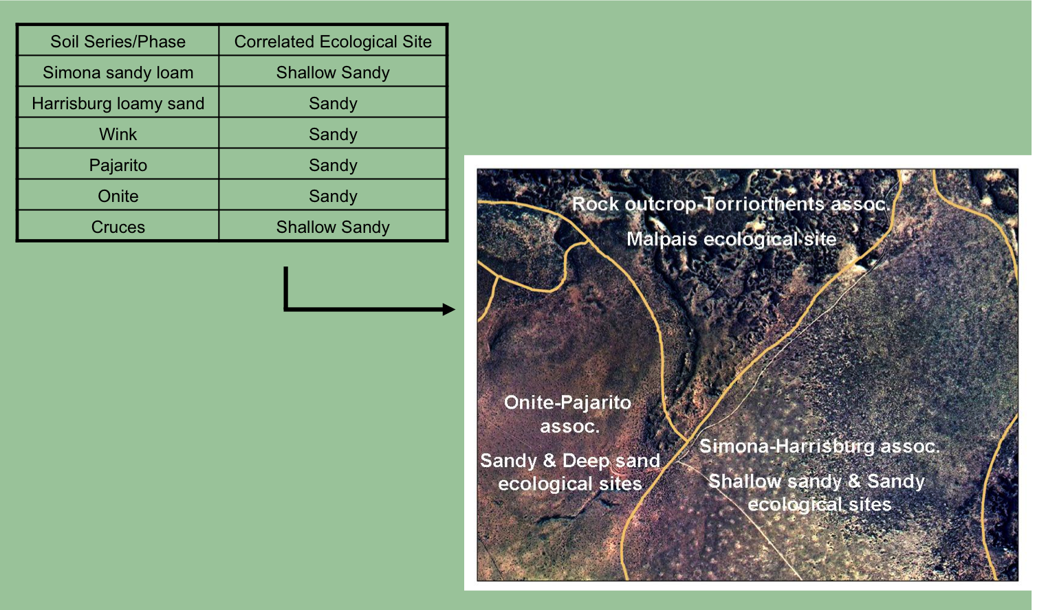
Once we have identified the soil components present, the next step is to review ecological sites and their descriptions (ESDs). Each time you download a soil survey, the download comes with two folders (Spatial and Tabular). The tabular data contains an empty database and numerous tables. If you point the database to the folder where the tables are located, the database will import the data tables. This allows you to see each soil phase’s correlated ecological site. A given soil component can be correlated to only one ecological site. Each ecological site is typically associated with multiple soil components that are similar in their soil properties and potential plant communities. Acquiring the ecological site correlated to each soil component allows the creation of a spatial data layer where each soil map unit is linked to its dominant ecological site(s). |
|||
 |
|||
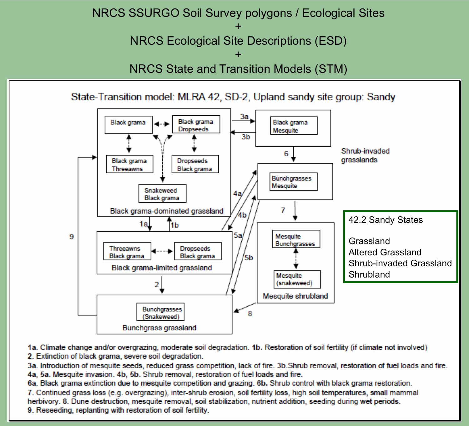
| Next, ecological sites descriptions are reviewed, including their state and transition models (STMs). A clear understanding of each ESD, its soil properties, vegetation communities, states and transitions/pathways is crucial for interpreting imagery and delineating state polygons. | |||
 |
|||
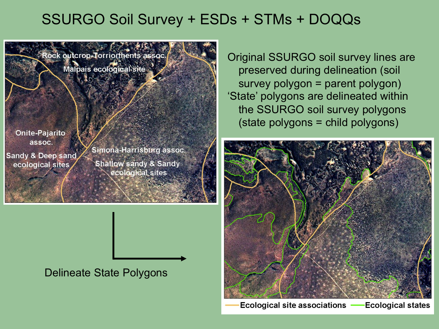
| Overlaying the soil survey on DOQQs allows us to delineate state polygons within SSURGO soil map units. During the delineation process, soil map unit polygons are “cut” into smaller state polygons. The soil survey lines are preserved; polygons belonging to separate soil map units are never merged (even if they are the same ecological site and state). The state mapping technician uses the information gathered from ESDs and STMs when interpreting the imagery and determining where to divide ecological state polygons. | |||
|
|
 |
||
Quick links:
|
|||