 |
|||
|
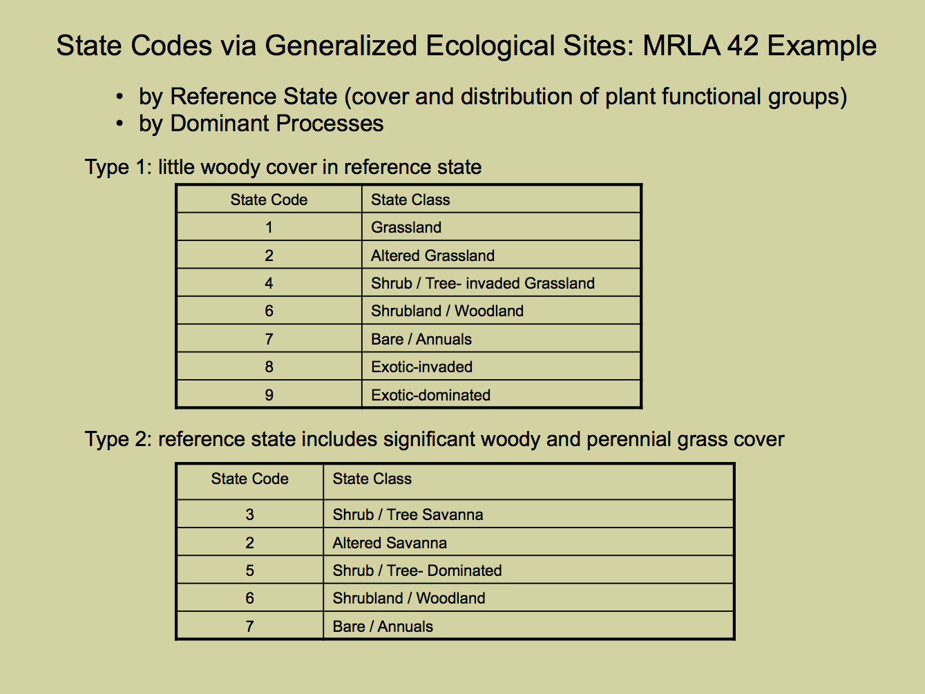
Once all of the data needed is gathered together and overlain on DOQQs, polygons can be attributed with the ecological site and a three-digit state code. The first number in the state code represents the dominant ecological state within the polygon of interest. The second digit represents the second dominant state, and the third is the third dominant state. Where only one or two states occur in a polygon, a zero follows the dominant state code(s). See Steele, CM, et al., (in press) Spatially-explicit representation of state-and-transition models, for more information. In order to standardize the assignment of state codes to each polygon, each ecological site within an area of interest is grouped to a “Generalized Ecological Site” class. This is typically done at the MRLA level. Members of a generalized ecological site are structurally similar in their reference states and follow the same general STM. The generalized ecological site determines the possible ecological state codes. It is important to recognize and address potential weaknesses of ESDs and STMs. |
|||
|
|
 |
||
Quick links:
|
|||