Mapping Ecological States [1]
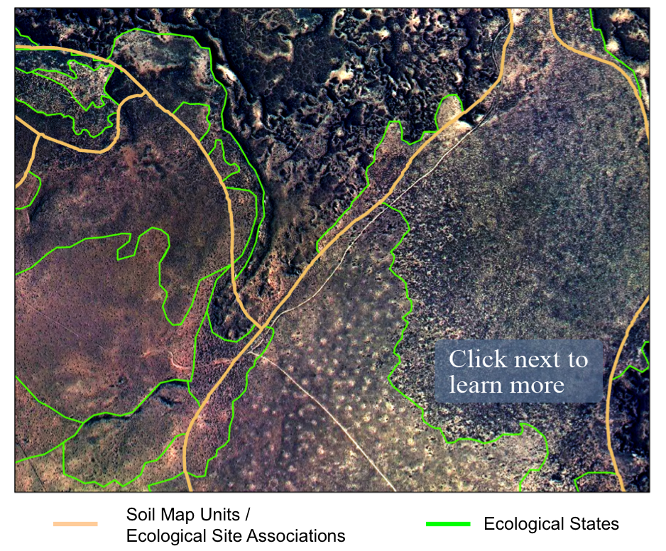
| State maps are spatial representations of vegetation states of the ecological sites occurring in a landscape. They are high resolution vegetation and soil maps that are linked to Ecological Site Descriptions (ESDs) and state-and-transition models (STMs). | |||
|
|
|||
 [2] [2] |
|||
Quick links:
|
"Better Maps Mean Better Rangeland Management [10]" - from the July 2013 issue of Agricultural Research, the U.S. Department of Agriculture's science magazine [10] [10] |
||